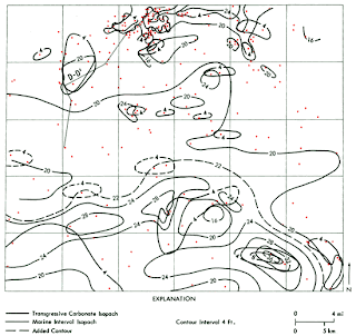
Isopach
Isopach maps uses contour lines to map the variation of thickness of a stratum over a specific area. This specific isopach is picturing the apparent water resistivity that has been measured given a formula. The varying lines show the difference in resistance in the water stream.

No comments:
Post a Comment